North West England
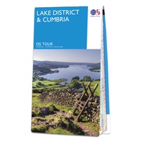 Fietskaart 3 Tour Map Lake District & Cumbria | Ordnance Survey
De Ordnance Survey Tour Maps met schaal 1:100.000 zijn uitstekend geschikt om zelf je fietsvakantie te plannen in Engeland. Ze laten alle alle grote en kleinere wegen zien. Bovendien staan …
★★★★★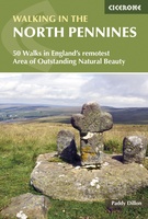 Wandelgids Walking in the North Pennines | Cicerone
Uitstekende wandelgids van dit geweldige gebied. goed beschreven met veel praktische informatie om de route te kunnen lopen, inclusief redelijke kaarten. This guidebook describes 50 day walks across the North …
 Wandelkaart Hadrian's Wall | Harvey Maps
Een bijzonder handige kaart van dit lange-afstands-wandelpad. Op waterafstotend papier met veel details. Het enige dat je eigenlijk een beetje mist is een overzicht. Verder uitstekend en voldoende voor de …
★★★★★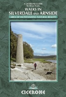 Wandelgids Walks in Silverdale and Arnside - rand van Lake District | Cicerone
Second edition of a popular walking guide to Silverdale and Arnside Area of Outstanding Natural Beauty (AONB), at the top of Morecambe Bay in Cumbria and Lancashire, north west England, …
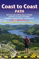 Wandelgids Coast to Coast Path: St Bees to Robin Hood's Bay | Trailblazer Guides
Goede wandelgids van de hele route van kust naar kust. Met veel details zijn alle etappes beschreven. Tevens informatie over overnachtingen en openbaar vervoer. All the information you need to …
★★★★★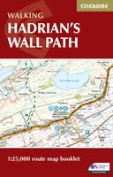 Wandelatlas Hadrian's Wall Path Map Booklet | Cicerone
All the mapping you need to walk the 84 mile (135km) Hadrian's Wall Path from Bowness-on-Solway in Cumbria to Wallsend, Newcastle. This booklet of Ordnance Survey 1:25,000 Explorer maps has …
 Fietsgids Cycling the Pennine Bridleway | Cicerone
 Wandelkaart Dales Way | Harvey Maps
Mooie, duidelijke kaart van de Dales Way in Noord-Engeland. Geplastificeerd met veel extra informatie en uitsnedes van de route. A leap forward in technical excellence: Tough, durable and 100% …
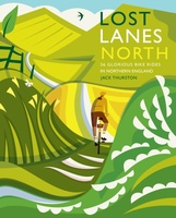 Fietsgids Lost Lanes North | Wild Things Publishing
Jack Thurston, best-selling author of the Lost Lanes series (50,000 sold) and presenter of the Bike Show, takes you on a freewheeling tour of the lost lanes and forgotten byways …
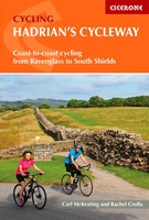 Fietsgids Hadrian's Cycleway | Cicerone
Hadrian's Cycleway is a 174 mile route from Ravenglass in Cumbria to South Shields. Also known as Route 72, this coast-to-coast route heads north up the Cumbrian coast to reach …
★★★★★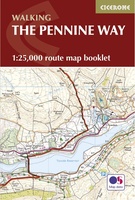 Wandelatlas Pennine Way Map Booklet | Cicerone
Heel handig bedacht van uitgever Cicerone: een boekje dat dienst doet als atlas met alle topografische kaarten die je nodig hebt voor het lopen van de Pennine Way. Past goed …
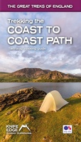 Wandelgids Trekking the Coast to Coast Path | Knife Edge Outdoor
The definitive two-way guide to the Coast to Coast Path: both eastbound and westbound routes are described in full. Real Maps: Full Ordnance Survey mapping inside (1:25,000). All accommodation is …
★★★★★ Spoorwegenkaart England North and Central Rail and Road | ITMB
This is a new title for ITMB, and continues our expanded coverage of the United Kingdom. Many publishers carry a map of Great Britain (or of the UK), and a …
 Campergids 96 nach England, der Norden | WOMO verlag
Tourenkarten Auf rund 4400 km in 11 Touren zu allen großen Attraktionen und weniger bekannten Orten in Nordengland reisen. Genaue Markierung freier Stell-, Bade-, Picknick-, Wander-, Pub- und Campingplätze incl. …
 Wegenkaart - landkaart Nord- und Mittelengland / Northern England & the Midlands | Reise Know-How Verlag
Hochreißfeste und 100% wasserfeste Landkarte "Nord- und Mittelengland" aus der Serie world mapping project, erschienen im Reise Know-How Verlag. Reise Know-How Landkarten zeichnen sich durch besonders stabiles Kunststoffpapier aus, …
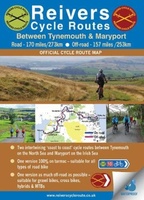 Fietskaart Reivers Cycle Routes | Northern Heritage Services
The long-distance Reivers Cycle Routes are two intertwining signed / waymarked bi-directional ‘coast to coast’ cycle routes between the North Sea and the Irish Sea. The original Reivers Cycle …
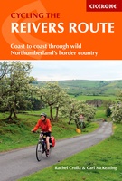 Fietsgids Cycling the Reivers Route | Cicerone
Guidebook to the Reivers Route, a 173 mile (280km) coast-to-coast cycle route across northern England and into Scotland from Tynemouth to Whitehaven. Exploring the rich history of traditional border territory, …
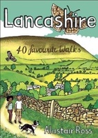 Wandelgids Lancashire | Pocket Mountains
Handige compacte wandelgids met 40 dagwandelingen. Deze gids bevat kleine kaartjes en leuke uitgebreide informatie over wat er langs de route te zien is. Goede wandelkaarten zijn echter we noodzakelijk …
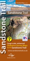 Wandelkaart Walking Cheshire's Sandstone Trail - 1:25,000 OS Map Book | Northern Eye Books
Large-scale Ordnance Survey maps for walking Cheshire’s Sandstone Trail in a handy pocket size book. Cheshire’s Sandstone Trail is probably the most popular middle-distance walk in Northwest England. Here, …
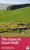 Wandelgids Coast to Coast Walk - van Ierse Zee tot Noordzee | Aurum Press
Goede gids over dit inmiddels beroemde pad. Kaartmateriaal is perfect, alsmede achtergrondinformatie. Praktische info wat minder, maar die is op de ramblerssite op internet te vinden! The Coast to Coast …
Laatste reviews

Uitgebreide en zeer overzichtelijke kaart, bijna alles staat erop. Handig formaat en past mooi bij de aangeschafte gids.
★★★★★ door Toon Meesters 02 januari 2025 | Heeft dit artikel gekocht
Wil komende zomer naar dit schiereiland. Dit boek heeft ons nog enthousiaster gemaakt. Zeer informatief en volledig en toch in handig formaat
★★★★★ door Toon Meesters 02 januari 2025 | Heeft dit artikel gekocht
Goede omschrijving van producten, Duidelijke website en zoekmachine Snelle levering Zeer tevreden
★★★★★ door Paul Out 02 januari 2025 | Heeft dit artikel gekocht
Pakket is met de feestdagen snel en netjes verzonden. Is precies de landkaart die we zochten. Erg tevreden
★★★★★ door Marieke 01 januari 2025 | Heeft dit artikel gekocht

