Wandkaarten van landen - Europa
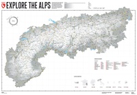 Wandkaart Alpen Gestalten | 140 x 100 cm | Marmota Maps
Gipfel, Pässe, Täler, Bäche und Seen, Wälder, Almen. Ski-, Rad-, oder Wanderrouten. Besuchte oder noch zu besuchende Ortschaften und Regionen. Von den Seealpen bis zum Wienerwald, vom Watzmann bis zum …
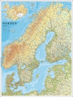
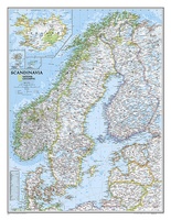 Wandkaart Scandinavië en Ijsland, 60 x 77 cm | National Geographic
National Geographic Wall Maps offer a special glimpse into current and historical events, and they inform about the world and environment. Offered in a variety of styles and formats, these …
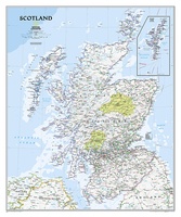 Wandkaart 20533 Schotland, 76 x 91 cm | National Geographic
This new map of Scotland, features our rich, antique-inspired Executive style. This beautiful map includes thousands of place names, accurate political boundaries, national parks, archeological sites, and major infrastructure networks …
★★★★★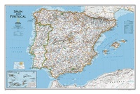 Wandkaart 22070 Spain - Spanje & Portugal 83 x 55 cm | National Geographic
This classic-style map of Spain and Portugal shows political boundaries, major highways and roads, cities and towns, airports and other geographic details. Thousands of place-names and exact borders are carefully …
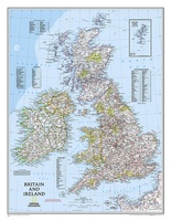 Wandkaart 02022 Britain and Ireland - Groot Brittannië en Ierland, 60 x 76 cm | National Geographic
This classic-style map of England and Wales shows political boundaries, major highways and roads, cities and towns, airports, and other geographic details. Thousands of place-names and exact borders are carefully …
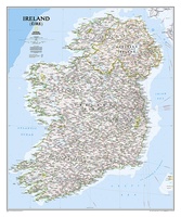 Wandkaart 20427 Ireland – Ierland, 76 x 91 cm | National Geographic
National Geographic Maps' new Ireland wall map is one of the most authoritative maps yet published of the Emerald Isle. Of the nearly 1,000 place-names shown on this map, all …
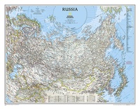 Wandkaart 22091 Russia – Rusland, 77 x 60 cm | National Geographic
Our classic wall map of Russia and the independent states of the former Soviet Union shows thousands of place names, roadways, political boundaries, bodies of water, airports, and many other …
 Wandkaart 1301 Griekenland Natuurkundig, 70 x 100 cm | Orama
Mooie natuurkundige kaart van Griekenland met namen in het Grieks.
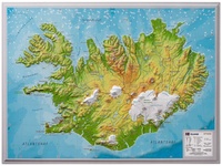 Wandkaart - Reliëfkaart IJsland met voelbaar 3D reliëf 42 x 30 cm | GeoRelief
Prachtig vormgegeven wandkaart van IIsland met reliëf. Uitgevoerd in stevig kunststof is IJsland vanzelfsprekend een land dat zich bij uitstek leent voor een 3D kaart: zo komen de bergmassieven, maar …
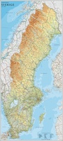
★★★★★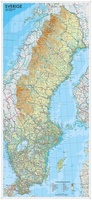 Wandkaart Zweden 55 x 123 cm | Norstedts
Een wandkaart van Zweden in een iets kleiner formaat om aan de muur te hangen. Decoratieve kleuren laten verschillende hoogtelagen zien en maken onder andere de Zweedse bergketen duidelijk. Hoofdwegen, …
★★★★★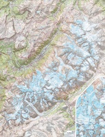 Wandkaart Mont Blanc 100 x 131 cm | IGN - Institut Géographique National
Gelamineerde wandkaart van het Mont Blanc-massief uitgegeven door IGN. Een topografische poster van zeer grote precisie geproduceerd door de gedeeltelijke montage van verschillende TOP 25. Het bevat alle details …
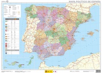 Wandkaart Spanje, 70 x 50 cm | CNIG - Instituto Geográfico Nacional
Administrative provinces of Spain shown in bright colours on a wall map at 1:2,250,000, size 70 x 50cm (27.5" x 20" approx), from IGN/CNIG - the country’s civilian survey organization, …
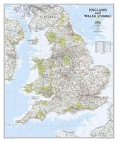 Wandkaart 20664 Engeland en Wales, 76 x 92 cm | National Geographic
This classic-style map of England and Wales shows political boundaries, major highways and roads, cities and towns, airports, and other geographic details. Thousands of place-names and exact borders are carefully …
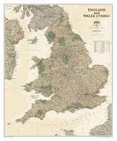 Wandkaart 20667 Engeland en Wales, antiek, 76 x 91 cm | National Geographic
This earth-toned, executive-style map of England and Wales shows political boundaries, major highways and roads, cities and towns, airports, and other geographic details. Thousands of place-names and exact borders are …
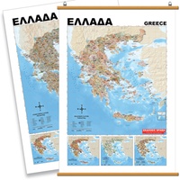
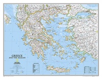 Wandkaart 22111 Greece – Griekenland, 77 x 60 cm | National Geographic
Decoratieve wandkaart van Griekenland. Naast de mooie kleuren staan er bijzonder veel plaatsen op vermeld. The classic National Geographic wall map of Greece shows this beautiful area in uncompromisingly …
 Wandkaart Das Grosse Alpen - panorama, sommer / zomer uitgave | MairDumont
Wandkaart van de hele Alpen van oost naar west met de namen van de bergtoppen. Mooie uitvoering om in details alle valleien en bergruggen te zien. De mogelijkheden om te …
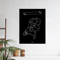 Wandkaart Krijtbord Nederland Woody Map Chalkboard | Miss Wood
Naast de bekende Woody Map prikborden komt het Spaanse merk Miss Wood nu met een zwarte met krijt beschrijfbare kleeffolie waarop Nederland staat afgebeeld. Er worden 6 krijtjes in verschillende …
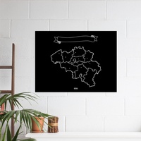 Opruiming - Wandkaart Krijtbord België Woody Map Chalkboard | Miss Wood
Naast de bekende Woody Map prikborden komt het Spaanse merk Miss Wood nu met een zwarte met krijt beschrijfbare kleeffolie waarop België staat afgebeeld. Er worden 6 krijtjes in verschillende …
★★★★★ Wandkaart Scandinavië en IJsland, 75 x 100 cm | Norstedts
Prachtige wandkaart van Scandinavië met een inzet van IJsland. Hele duidelijke kaart waar door het kleurgebruik de natuurkundige aspecten als hoogte, bergen en fjorden heel goed uitkomt. Daarnaast zjin er …
★★★★★ Wandkaart Zweden, 79 x 177 cm | Norstedts
Een grote kaart van Zweden voor aan de muur. Decoratieve kleuren tonen verschillende hoogten en Zweedse bergketens. Belangrijke wegen, spoorwegen en steden zijn duidelijk herkenbaar. Wordt geleverd op rol …
★★★★★
Laatste reviews

Deze kaarten gebruik ik om mooie wandelingen uit te zetten, die ik dan met mijn liefste meisje beloop. Dank u wel voor de snelle adequate …
★★★★★ door Jacques Marks 03 december 2024 | Heeft dit artikel gekocht
Ook ik ben een zwerver, maar gelukkig niet dakloos. Deze kaarten gebruik ik om mooie wandelingen uit te zetten, die ik dan met mijn liefste …
★★★★★ door Jacques Marks 03 december 2024 | Heeft dit artikel gekocht
Perfect👍
★★★★★ door Wilma & Mari 03 december 2024 | Heeft dit artikel gekocht
Vooralsnog ben ik tevreden met de kaart. Hij werd vlot bezorgd en ik kan hem goed lezen. De echte proof of the pudding vindt echter …
★★★★★ door Jan Piebe Tjepkema 03 december 2024 | Heeft dit artikel gekocht