Kaarten
De beste wegenkaarten, routekaarten, fiets- of wandelkaarten en topografische kaarten vindt u hier!
 Wandelkaart 294 Klagenfurt und Umgebung | Kompass
Goede wandelkaart met vrijwel alle topografische details als hoogtelijnen, vegetatie, schaduwtekening maar ook de ingetekende wandelroutes en in veel gevallen ook fietsroutes (MTB). Gevaarlijke routes worden als zodanig weergegeven met …
 Wegenkaart - landkaart 457 Mysterious South Albania - Rajonit Bregdetar Jugor | Vektor
Handige overzichtskaart van een stuk in het Zuiden van Albanie met ingetekende wandel- en fietsroutes.
 Wandelkaart Münster und Umgebung | GeoMap
Wanderkarte Münster und Umgebung 1:35.000 auf Grundlage der amtlichen topographischen Geobasisdaten des Landes NRW und dem Freizeitkataster NRW. Topographische Karte mit Wanderwegen und Freizeitinformationen.
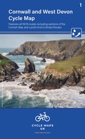 Fietskaart 01 Cycle Maps UK Cornwall and West Devon | Cordee
Een nieuwe fietskaarten serie van Groot-Brittannië. Gedrukt op scheur- en watervast papier en mooi handzaam klein formaat. Deze kaarten zijn met name heel goed om de Lange Afstands Fietsroutes (LF) …
 Fietskaart 06 Cycle Maps UK London and Essex | Cordee
Een nieuwe fietskaarten serie van Groot-Brittannië. Gedrukt op scheur- en watervast papier en mooi handzaam klein formaat. Deze kaarten zijn met name heel goed om de Lange Afstands Fietsroutes (LF) …
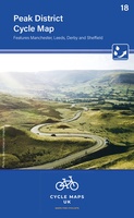 Fietskaart 18 Cycle Maps UK Peak District | Cordee
Een nieuwe fietskaarten serie van Groot-Brittannië. Gedrukt op scheur- en watervast papier en mooi handzaam klein formaat. Deze kaarten zijn met name heel goed om de Lange Afstands Fietsroutes (LF) …
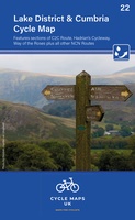 Fietskaart 22 Cycle Maps UK Lake District and Cumbria | Cordee
Een nieuwe fietskaarten serie van Groot-Brittannië. Gedrukt op scheur- en watervast papier en mooi handzaam klein formaat. Deze kaarten zijn met name heel goed om de Lange Afstands Fietsroutes (LF) …
 Fietskaart 24 Cycle Maps UK Edinburgh - Central Southern Scotland | Cordee
Een nieuwe fietskaarten serie van Groot-Brittannië. Gedrukt op scheur- en watervast papier en mooi handzaam klein formaat. Deze kaarten zijn met name heel goed om de Lange Afstands Fietsroutes (LF) …
★★★★★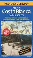 Fietskaart Costa Blanca North | Active Maps Limited
A 100,000 scale detailed road cycle map for North Costa Blanca (the coastal zone and mountains around Denia, Xabia/Javea, Moraira, Calpe, Altea & Benidorm). Easy cycle route planning with road …
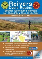 Fietskaart Reivers Cycle Routes | Northern Heritage Services
The long-distance Reivers Cycle Routes are two intertwining signed / waymarked bi-directional ‘coast to coast’ cycle routes between the North Sea and the Irish Sea. The original Reivers Cycle …
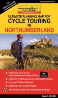 Fietskaart Cycle Touring Map of Northumberland | Northern Heritage Services
The official planner for recreational cycling and cycle touring in Northumberland and beyond. Version 3 printed 2020. Comprehensive list of promoted long distance cycle routes including: Coast and Castles …
★★★★★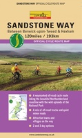 Fietskaart Sandstone Way - Northumberland Cycle Route Map | Northern Heritage Services
The Sandstone Way is a 120-mile mountain biking route between Berwick upon Tweed and Hexham that runs along the sandstone ridge in North Northumberland, linking numerous sandstone crags and outcrops. …
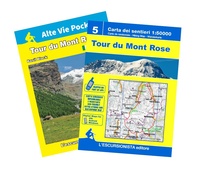 Wandelkaart 5 Tour du Mont Rose - Monte Rosa | L'Escursionista editore
Die Tour des Mont Rose ist ein Rundkurs in 10 Etappen um das Massiv des Monte Rosa und des Mischabel, in den Penninischen oder Walliser Alpen. Sie überquert im Wallis …
★★★★★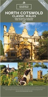 Wandelkaart North Cotswold Classic Walks | Goldeneye
With 10 circular, clearly-marked routes this easy-to-use map will help you discover the Cotswolds via some of the finest pubs and tearooms. Step into the Cotswolds with these exceptionally …
 Fietskaart 09 Cycling guides Norfolk | Goldeneye
Norfolk is the fourth largest county in England and one of the most rural. It is also one of the flattest and our circular routes have been chosen to explore …
 Fietsknooppuntenkaart ADFC Radwanderkarte Grafschaft Bentheim | BVA BikeMedia
Deze kaart is uitstekend geschikt voor dagtochten en weekenduitjes. Het omvat het speciale fietsroutenetwerk en alle lange-afstandsfietsroutes van de regio, zodat u de schoonheid van het landschap ten volle kunt …
★★★★★ Fietsknooppuntenkaart - Fietskaart ADFC Regionalkarte Almark | BVA BikeMedia
Ideal für Tagesausflüge und WochenendtourenInhalte vor Ort von ADFC-Scouts recherchiertmit Tagestouren-Vorschlägenmit UTM-Koordinatengitter zur Entfernungsmessung und Standortbestimmung mit GPS-Gerätenwetterfestes und reißfestes Papierzusätzliche kostenfreie Online-Angebote:gpx-Tracks der Themenrouten, Radfernwege und Tourenvorschläge zum Download
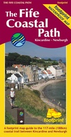 Wandelkaart The Fife Coastal Path | Footprint maps
A handy, waterproof map breaking down the Fife Pilgrim Way into seven sections. The Fife Pilgrim Way runs between North Queensferry or Culross and St Andrews. It is designed as …
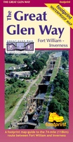 Wandelkaart The Great Glen Way | Footprint maps
The complete map/guide of both routes between Fort William and Inverness. Also contains compact and concise practical information for walkers. For every copy of this map sold, a …
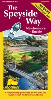 Wandelkaart The Speyside Way | Footprint maps
The Speyside Way is one of 'Scotland's Great Trails'. It runs between Newtonmore, in the heart of Strathspey, 87 miles to Buckie, on the Moray Firth. The route passes through …
Laatste reviews

Prima koop
★★★★★ door Paul van Schelt 26 november 2024 | Heeft dit artikel gekocht
Het product wat ik van u heb ontvangen is prima !! maar voldoet niet geheel aan mijn verwachtingen want ik had een iets overzichtelijkere plattegrond …
★★★★★ door W. Breeschoten 26 november 2024 | Heeft dit artikel gekocht
De kaart NEPAL is netjes uitgevoerd en voldoet bijna aan mijn wensen : De plattegrond van KATHMANDU had ik liever iets uitvoeriger gezien en voorzien …
★★★★★ door Wout Breeschoten 26 november 2024 | Heeft dit artikel gekocht
Het is een mooi boekje, super handig. Beter dan de volwassen versie.
★★★★★ door Petra 26 november 2024 | Heeft dit artikel gekocht

