Mandje Tel: +31503126950 Menu
Winkelwagen
Geen items in winkelwagen
Ga naar winkelwagen

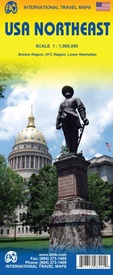
Wegenkaart - landkaart USA Northeast - Noordoost USA | ITMB (9781771298421)

Boston Region, NYC Region, Lower Manhattan

  • ISBN / CODE: 9781771298421
  • Editie: 17-09-2015
  • Druk: 1
  • Aantal blz.: 1
  • Schaal: 1:1000000
  • Uitgever: ITMB
  • Soort: Wegenkaart
  • Taal: Engels
  • Hoogte: 25.0 cm
  • Breedte: 10.0 cm
  • Gewicht: 53.0 g
  • Uitvoering: Papier
  • Beoordeling: 5,0 ★★★★★ (1 review) Schrijf een review
  • 13,95

    Op voorraad. Binnen 2 - 3 werkdagen in huis in Belgie Levertijd Nederland Voor 17.00 uur op werkdagen besteld, morgen in huis in Nederland Levertijd Belgie

    Gratis verzending in Nederland vanaf €35,-

Beschrijving

Een degelijke wegenkaart van het noordoosten van de USA. (1:1.000.000) met aanduidingen van o.a. nationale parken, vliegveld, benzinepomp, dirt-roads. Als overzichtskaart goed te gebruiken.

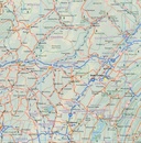
(1:1.000.000 Scale) including adjacent US states and bordering Canada . We started it wanting to do a map of just New England, but that will have to be a future title. By the shape of the USA, the New England States fill most of one side of the map, but New York City and Philadelphia are included as well as a goodly portion of New York State. The second side covers the rest of the state, plus all of New Jersey, Delaware, Maryland, Pennsylvania, and most of Ohio, West Virginia and the northern portion of Virginia. In terms of cities, Cincinnati is at the bottom left of the sheet and Richmond at the bottom right, with Detroit at upper left and Albany at upper right. The value of this map for visitors is that it covers a reasonably comprehensive portion of the USA, stretching as it does from northern Maine to south of Washington, DC. Thus, for someone driving from Canada or flying into Boston or NYC, this map offers the ability to travel using a sectional maps of a region, rather than having to rely on a variety of state maps for political entities that are geographically quite small (sorry, but they are). The map shows motorway interstates in blue and tries to show every interchange, main highways, and significant secondary roads that connect. Although place name inclusion is extensive, at this scale it is impossible to note all villages, especially in the vicinity of major urban areas. Parks, higher education institutes, ski areas, battlefields, airports, rail lines, and touristic attractions are all shown.
 
Legend Includes:
Roads by classification, Points of Interest, National Parks, Airports, Golf Courses, Beaches, Campsites, Waterfalls, Viewpoints, Churches, Surfing/Scuba Diving Spots, Fishing Spots, Hospitals, harbours/Ports, Lighthouses, Museums, Monuments, Caves, Mosques, Mountain Peaks, Botanic Gardens, Wildlife Sanctuary, Zoos, Sports Fields, and much more.


Reviews

Prima kaart

Ja, zeer tevreden. Prima kaart. Goed verzorgd aangekomen. Ga zo door.

★★★★★ door G. van Veggel 28 januari 2016

Vond u dit een nuttige review? (login om te beoordelen)

-
Nee (0)

Schrijf een review

Graag horen wij wat u van dit artikel vindt. Vindt u het goed, leuk, mooi, slecht, lelijk, onbruikbaar of erg handig: schrijf gerust alles op! Het is niet alleen leuk om te doen maar u informeert andere klanten er ook nog mee!