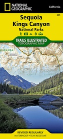
Wandelkaart - Topografische kaart 205 Sequoia - Kings Canyon National Parks | National Geographic (9781566952989)
- ISBN / CODE: 9781566952989
- Editie: 01-10-2023
- Aantal blz.: 1
- Schaal: 1:80000
- Uitgever: National Geographic
- Soort: Topografische kaart, Wandelkaart
- Taal: Engels
- Hoogte: 19.0 cm
- Breedte: 10.0 cm
- Gewicht: 94.0 g
- Uitvoering: Scheur- en watervast
- Bindwijze: -
- Beoordeling: 5,0 ★★★★★ (1 review) Schrijf een review
-
€ 16,95
Leverbaar in 3 - 5 werkdagen in huis in Nederland Levertijd Belgie
Gratis verzending in Nederland vanaf €35,-
-
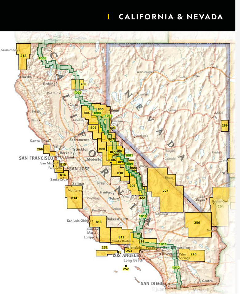
Overzicht Wandelkaarten California Trails Illustrated National Geographic


Producten op deze overzichtskaart:
Klik op een product om naar de pagina van dat product te gaan.
- Wandelatlas - Wandelkaart 1001 John Muir Trail | National Geographic
- Wandelkaart 1006 Pacific Crest Trail: Klamath Mountains /CA | National Geographic
- Wandelkaart 1007 Pacific Crest Trail: Shasta & Lassen /CA | National Geographic
- Wandelkaart 1008 Pacific Crest Trail: Sierra Nevada North | National Geographic
- Wandelkaart - Topografische kaart 205 Sequoia - Kings Canyon National Parks | National Geographic
- Wandelkaart - Topografische kaart 206 Yosemite National Park | National Geographic
- Wandelkaart 218 Redwood National & State Parks | National Geographic
- Wandelkaart - Topografische kaart 221 Trails Illustrated Death Valley National Park | National Geographic
- Wandelkaart - Topografische kaart 226 Joshua Tree National Park | National Geographic
- Wandelkaart - Topografische kaart 256 Mojave National Preserve | National Geographic
- Wandelkaart 268 Lassen Volcanic National Park | National Geographic
- Wandelkaart - Topografische kaart 306 Yosemite SW - Yosemite Valley & Wawona | National Geographic
- Wandelkaart - Topografische kaart 307 Yosemite NW - Hetch Hetchy Reservoir | National Geographic
- Wandelkaart - Topografische kaart 308 Yosemite NE - Tuolumne Meadows and Hoover Wilderness | National Geographic
- Wandelkaart 309 Yosemite SE - Ansel Adams Wilderness | National Geographic
- Wandelkaart - Topografische kaart 803 Lake Tahoe Basin | National Geographic
- Wandelkaart 804 Tahoe National Forest West - Yuba & American Rivers | National Geographic
- Wandelkaart 805 Tahoe National Forest East - Sierra Buttes, Donner Pass | National Geographic
- Wandelkaart - Topografische kaart 809 Mammoth Lakes - Mono Divide - Inyo and Sierra National Forests | National Geographic
- Wandelkaart - Topografische kaart 810 Shaver Lake - Sierra National Forest | National Geographic
- Wandelkaart 811 Angeles National Forest | National Geographic
- Wandelkaart 812 Los Padres National Forest East | National Geographic
- Wandelkaart 814 Big Sur / Ventana Wilderness /CA | National Geographic
Overzichtskaarten
Beschrijving
Prachtige geplastificeerde kaart van het nationaal park. Met alle recreatieve voorzieningen als campsites, maar ook met topografische details en wandelroutes ed. Door uitgekiend kleurgebruik zeer prettig in gebruik. Scheur en watervast!
Trails Illustrated maps are the most trusted and popular recreation maps available. Continually setting the standard for accuracy, each map is crafted in conjunction with local land managers, and undergoes rigorous review and enhancement before being printed on waterproof, tear-resistant material.
Each Trails Illustrated map contains detailed topographic information, clearly marked and named trails, recreational points of interest, and navigational aids. National Park series maps contain useful details for planning your visit. State series titles cover popular recreation areas, ideal for done-in-a-day activities.
Reviews
Mooie stevige kaart, handzame maat ook. Van dezelfde serie hebben we Las Vegas en San Franciso al. Een echte aanrader.
★★★★★ door Anita.van den Bosch-de GIer 9 maart 2013Vond u dit een nuttige review? (login om te beoordelen)
Schrijf een review
Graag horen wij wat u van dit artikel vindt. Vindt u het goed, leuk, mooi, slecht, lelijk, onbruikbaar of erg handig: schrijf gerust alles op! Het is niet alleen leuk om te doen maar u informeert andere klanten er ook nog mee!


