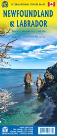
Wegenkaart - landkaart Newfoundland & Labrador | ITMB (9781771295833)
- ISBN / CODE: 9781771295833
- Editie: 01-01-2024
- Druk: 5
- Aantal blz.: 1
- Schaal: 1:800000
- Uitgever: ITMB
- Soort: Wegenkaart
- Taal: Engels
- Hoogte: 25.0 cm
- Breedte: 10.0 cm
- Dikte: 0.5 cm
- Gewicht: 54.0 g
- Uitvoering: Papier
- Bindwijze: -
- Beoordeling: 4,0 ★★★★★ (1 review) Schrijf een review
-
€ 13,95
Op voorraad. Voor 17.00 uur op werkdagen besteld, binnen 1 tot 2 werkdagen in huis in Nederland Levertijd Belgie
Gratis verzending in Nederland vanaf €35,-
Beschrijving
Double-sided map of Newfoundland and Labrador Provinces at 1:800,000 and 1:1,300,000 respectively, part of a series of maps of Canadian provinces from the Vancouver-based ITMB, with topography presented by altitude colouring rather than by relief shading.
Road and rail networks are shown on a clear base with numerous national or regional parks and wildlife reserves prominently marked. The Trans Canada Trail is prominently indicated; symbols highlight various places of interest, sport and recreational facilities, etc. National, provincial and time zone boundaries are displayed. The map has a latitude and longitude grid at intervals of 1º and an index of localities. Historical information is given on the outer edges of the map, with a small box showing the timeline of the provinces, dating back to the 11th century.
Also included are plans of Conception bay South and St. John’s, indicating one-way streets, points of interest, and various facilities.
Reviews
Goede kaart, wel op heel licht paper gedrukt, dus beetje kwetsbaar.
★★★★★ door Martijn Bak 21 april 2017Vond u dit een nuttige review? (login om te beoordelen)
Schrijf een review
Graag horen wij wat u van dit artikel vindt. Vindt u het goed, leuk, mooi, slecht, lelijk, onbruikbaar of erg handig: schrijf gerust alles op! Het is niet alleen leuk om te doen maar u informeert andere klanten er ook nog mee!


