Wegenkaart - landkaart Bonaire | Kasprowski Maps (9791095793021)
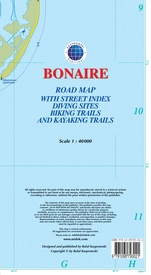
Road Map with Street Index, Diving Sites, Biking Trails, and Kayaking Trails
- ISBN / CODE: 9791095793021
- Editie: 01-01-2016
- Aantal blz.: 1
- Schaal: 1:40000
- Uitgever: Kasprowski Maps
- Soort: Wegenkaart
- Taal: Engels
- Hoogte: 23.0 cm
- Breedte: 12.0 cm
- Gewicht: 85.0 g
- Uitvoering: Papier
- Bindwijze: -
- Beoordeling: 5,0 ★★★★★ (6 reviews) Schrijf een review
-
€ 18,50
Op voorraad. Voor 17.00 uur op werkdagen besteld, binnen 1 tot 2 werkdagen in huis in Nederland Levertijd Belgie
Gratis verzending in Nederland vanaf €35,-
Beschrijving
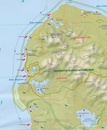
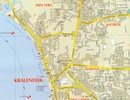
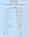
Bijzonder gedetailleerde kaart (1:40000) van alleen het eiland Bonaire. Zowel de wegen als ook de wandelpaden staan er op vermeld. Stranden, interessante plekken en bovendien de meeste duikplakken staan met diepte helder weergegeven op de kaart. Met stadsplattegrond van Kralendijk.
Reviews
Duidelijke kaart zeer bruikbaar voor mijn orientatie
★★★★★ door Ben 7 juni 2024 | Heeft dit artikel gekochtVond u dit een nuttige review? (login om te beoordelen)
Zeer gedetailleerde kaart van Bonaire. We hebben hem dagelijks gebruikt tijdens onze reis. Naast de wegen staan ook andere belangrijk zaken, zoals duiklocaties, tankstations en andere interessante plekken vermeld. Niet verder zoeken, gewoon deze kaart aanschaffen.
★★★★★ door Marijke 7 september 2023 | Heeft dit artikel gekochtVond u dit een nuttige review? (login om te beoordelen)
Een handige kaart om mee te nemen naar Bonaire. Zeker een aanrader! Want op de kaart staan de mooie snorkel- en duikplekken er als extra op. Maar ook alle andere plekjes die interessant zijn. In de 7 dagen van ons verblijf op dit eiland de kaart dagelijks gebruikt.
★★★★★ door Joke 5 december 2022 | Heeft dit artikel gekochtVond u dit een nuttige review? (login om te beoordelen)
Schrijf een review
Graag horen wij wat u van dit artikel vindt. Vindt u het goed, leuk, mooi, slecht, lelijk, onbruikbaar of erg handig: schrijf gerust alles op! Het is niet alleen leuk om te doen maar u informeert andere klanten er ook nog mee!


