Categorieën
- Nieuwe artikelen
-
Boeken
- Aanwijswoordenboeken
- Accommodatiegidsen
- Atlassen
- Bed and Breakfast Gidsen
- Bergsporthandboeken
- Campergidsen
- Camperhandboeken
- Campinggidsen
- Duikgidsen
- Fietsatlassen
- Fietsgidsen
- Fotoboeken
- Historische Atlassen
- Kanogidsen
- Kinderatlassen
- Kinderreisgidsen
- Kleurboeken
- Klimgids - Klettersteiggidsen
- Klimgids - Klimtopo
- Kookboeken
- Mountainbikegidsen
- Natuurgidsen
- Pelgrimsroutes
- Reisboeken
- Reisdagboeken
- Reisfotografiegidsen
- Reisgidsen
- Reishandboeken
- Reisinspiratieboeken
- Reisverhalen
- Sneeuwschoenwandelgidsen
- Survivalgidsen
- Tourskigidsen
- Treinreisgidsen
- Vaargidsen
- Vogelgidsen
-
Wandelgidsen
- Afrika
- Azië
-
Europa
- Albanië
- Andorra
- Armenië
- België
- Bosnië - Hercegovina
- Bulgarije
- Cyprus
- Denemarken
- Duitsland
- Engeland
- Estland
- Faroer
- Finland
- Frankrijk
- Georgië
- Griekenland
- Groenland
- Hongarije
- IJsland
- Ierland
- Italië
- Kosovo
- Kroatië
- Letland
- Liechtenstein
- Litouwen
- Luxemburg
- Malta
- Montenegro
- Nederland
- Noord-Ierland
- Noord-Macedonië
- Noorwegen
- Oostenrijk
- Polen
- Portugal
- Roemenië
- Scandinavië
-
Schotland
- Schotse Hooglanden & Speyside
- ♦ North Coast 500 | NC500
- ♦ Cairngorms National Park
- ♦ Loch Lomond & Trossach National Park
- Orkney Eilanden
- Shetlands | Shetlandeilanden
- Hebriden
- Ben Nevis - Glen Coe - Fort William
- Binnen-Hebriden
- Isle of Skye
- Arran
- Loch Ness en de Great Glen
- Lowlands | Schotse Laaglanden en grenzen
- ♦ Galloway Forest Park
- Aberdeen
- Edinburgh
- Glasgow
- 🥾 West Highland Way
- Servië
- Slovenië
- Slowakije
- Spanje
- Tsjechië
- Turkije
- Zweden
- Zwitserland
- Midden-Amerika
- Midden-Oosten
- Noord-Amerika
- Oceanië
- Wereld
- Zuid-Amerika
- Watersport handboeken
- Werken en wonen in buitenland
- Woordenboeken & Taalgidsen
- Kaarten
- Opruiming
- Puzzels
- Travel Gadgets
- Wandkaarten
- Wereldbollen
Veilig online betalen
Betaal veilig via uw eigen bankomgeving
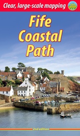
Wandelgids Fife Coastal Path | Rucksack Readers (9781913817008)
From Kincardine on the Forth to Newburgh on the Tay 187 km
- ISBN / CODE: 9781913817008
- Editie: 01-08-2022
- Druk: 2
- Aantal blz.: 80
- Schaal: 1:50000
- Auteur(s): Sandra Bardwell, Jacquetta Megarry
- Uitgever: Rucksack Readers
- Soort: Wandelgids
- Taal: Engels
- Hoogte: 22.0 cm
- Breedte: 13.0 cm
- Gewicht: 199.0 g
- Uitvoering: Scheur- en watervast
- Bindwijze: Paperback
- Schrijf als eerste een review
-
€ 23,95
Leverbaar in 3 - 5 werkdagen in huis in Belgie Levertijd Nederland Leverbaar in 3 - 5 werkdagen in huis in Nederland Levertijd Belgie
Gratis verzending in Nederland vanaf €35,-
- Extra Info
- Inkijkexemplaar
Beschrijving
The Fife Coastal Path runs around the coastline of eastern Scotland for 117 miles (187 km) from Kincardine on the Forth to Newburgh on the Tay. Starting west of the famous Forth bridges, the route heads through former mining towns towards the villages of Fife's East Neuk (corner), with their rich tradition of smuggling and fishing. After rounding Fife Ness, the route follows the coastline through St Andrews, golf capital of the world and former religious centre of Scotland.Fife has long played an important part in Scottish history and the route passes many castles, towers and churches. There are splendid views along the coast and over the Firths of Forth and Tay, with great chances to sight seabirds, seals and dolphins. The villages have welcoming pubs, famous fish-and-chip shops and good B&Bs. Transport by train and bus makes for easy access throughout.
- detailed directions for each section (walked anticlockwise from Kincardine)
- summaries showing distance, side-trips and food/drink stops
- background on history, landscapes and wildlife
- planning information for travel by bus, train, car and plane
- lavishly illustrated, with 100 colour photographs
- includes 16 pages of mapping at 1:45,000
- rucksack-friendly format, and printed on rainproof paper.
Reviews
Geen reviews gevonden voor dit product.
Schrijf een review
Graag horen wij wat u van dit artikel vindt. Vindt u het goed, leuk, mooi, slecht, lelijk, onbruikbaar of erg handig: schrijf gerust alles op! Het is niet alleen leuk om te doen maar u informeert andere klanten er ook nog mee!
Ook interessant voor europa/schotland/overig-zuid
-

Wandelkaart - Topografische kaart 32
€ 19,50Topografische kaarten Lowlands | Schotse Laaglanden en grenzen -

Wandelkaart - Topografische kaart 35
€ 19,50Topografische kaarten Lowlands | Schotse Laaglanden en grenzen -

Wandelkaart - Topografische kaart 37
€ 19,50Topografische kaarten Lowlands | Schotse Laaglanden en grenzen -

Wegenkaart - landkaart Pocket Map Ar
€ 7,95Wegenkaarten Lowlands | Schotse Laaglanden en grenzen -

Wandelgids Arran | Pocket Mountains
€ 10,95Wandelgidsen Lowlands | Schotse Laaglanden en grenzen


