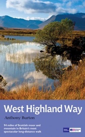
Wandelgids West Highland Way | Aurum Press (9781781315767)
- ISBN / CODE: 9781781315767
- Editie: 2016
- Aantal blz.: 144
- Auteur(s): Anthony Burton
- Uitgever: Aurum Press
- Soort: Wandelgids
- Serie: National Trail Guide
- Taal: Engels
- Uitvoering: -
- Bindwijze: Paperback
- Beoordeling: 1,0 ★★★★★ (1 review) Schrijf een review
-
€ 20,95
Op voorraad. Voor 17.00 uur op werkdagen besteld, binnen 1 tot 2 werkdagen in huis in Nederland Levertijd Belgie
Gratis verzending in Nederland vanaf €35,-
Beschrijving
Gedegen routegids van het beroemdste pad van Schotland. Uitstekende kaarten, goede achtergronden, helaas wat beperkte praktische informatie. Engels.
The 93-mile West Highland Way is indisputably Britain's most spectacular long-distance path. The first section, following the eastern shore of Loch Lomond, offers an idyllic waterside walk, with the full grandeur of the Highlands gradually revealing itself. Then, after crossing the barren wilderness of the Rannoch Moor, the walker climbs the Devil's Staircase above Glencoe and traverses classic Highland landscapes to reach Fort William and, if he or she wishes, a grand finale at the peak of Britain's highest mountain, Ben Nevis. This comprehensive, easy-to-use guide is an authoritative companion, packed with indispensable information.
The West Highland Way recreational Path Guide by Anthony Burton is the definitive guide to Britain’s most spectacular long distance walk.
This comprehensive, easy-to-use guide contains the entire route split into seven convenient sections, each accompanied by extracts from Ordnance Survey 1:25,000 Explorer maps, the standard walker's maps for the UK. Each section gives comprehensive route information and colour photographs, blending navigation and route details with history, background and local knowledge. Key sites are numbered in the text and on the map for easy identification. The guide also offers to the summits of Ben Lomond and Ben Nevis, the two 3000-foot-plus mountains, lying just off the main Trail, allowing you to make your own diversions.
Other sections of the guide cover general information for the whole trail, including local history, wildlife, geology, the West Highland railway, details of public transport, villages on or near the route with facilities for walkers, and a list of useful organisations and sources of further information on accommodation. Specific information for cyclists and horse-riders is also included.
Reviews
In dit bezoek wordt uitvoerig beschreven wat je kunt verwachten op de verschillende secties van de trail en er worden kaarten vermeld op dezelfde schaal als de meeste losse kaarten. Persoonlijk heb ik dit boek nauwelijks gelezen en uiteindelijk weggegeven. Ik hoef niet gedetailleerd te weten wat ik aan ga treffen - spoiler - en als gids is het veel te langdradig. Tevens ontbreekt een hoogtekaart. Geen aanrader, tenzij je houdt van veel voorpret en weinig verrassing. De Trailblazer gids vind ik veel handiger.
★★★★★ door Jeroen 12 september 2018 | Heeft dit artikel gekochtVond u dit een nuttige review? (login om te beoordelen)
Schrijf een review
Graag horen wij wat u van dit artikel vindt. Vindt u het goed, leuk, mooi, slecht, lelijk, onbruikbaar of erg handig: schrijf gerust alles op! Het is niet alleen leuk om te doen maar u informeert andere klanten er ook nog mee!


