Stadsplattegronden - Schotland
 Wegenkaart - landkaart - Stadsplattegrond Edinburgh & Southern Scotland | ITMB
Plattegrond van Edinburgh, schaal 1:10.000, met op de achterzijde een overzichtskaart van zuid Schotland, schaal 1:370.000. Legend Includes: Roads by classification, Airports, Ferry lines, Railways, Railway stations, Bus terminals, Bicycle …
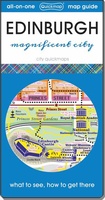 Stadsplattegrond Edinburgh | Quickmap
Handzame en handige plattegrond van Edinburgh met een goede kaart van het centrum. Bezienswaardigheden, bekende en minder bekende en openbaar vervoer vind je er op terug. Er zit geen register …
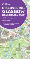 Stadsplattegrond Glasgow Illustrated Map | Collins
Explore new places with dependable maps from Collins. As the largest city in Scotland, Glasgow is a vibrant and bustling hub, enjoyed by thousands of visitors each year. This updated …
 Stadsplattegrond Popout Map Edinburgh | Compass Maps
Handig ( borstzak- ) formaat stadsplattegrond met voldoende detail, zodat je ook de kleinere straatjes erop aantreft. Van veel wereldsteden inmidddels leverbaar en dat is mooi, want juist in dit …
★★★★★ Stadsplattegrond Popout Map Glasgow | Compass Maps
Hele handige uitklapkaart van deze stad, bedenk wel: alleen het centrum! Explore the grand city of Glasgow with this handy, pop-up map. This genuinely pocket-sized Glasgow city map features a …
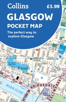 Stadsplattegrond Pocket Map Glasgow | Collins
Clear, detailed, full color Collins mapping is presented in a handy format ideal for the pocket or handbag. It is excellent value and covers the most visited area of central …
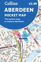 Stadsplattegrond Pocket Map Aberdeen | Collins
Handy little full colour Collins map of Aberdeen with a high level of detail. Clear mapping of the central area extending to the airport and along the coast, with all …
★★★★★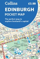 Stadsplattegrond Pocket Map Edinburgh | Collins
Handy little full colour map of central Edinburgh with a high level of detail. Clear mapping from Leith in the north to The Meadows in the south, and Edinburgh Zoo …
★★★★★ Stadsplattegrond City map Edinburgh - Edinburg | Lonely Planet
De stadsplattegronden van Lonely Planet zijn uitgevoerd op scheur- en watervast papier, zijn lichtgewicht en kennen een handig formaat. Het centrum van de stad is in heldere kleuren in beeld …
★★★★★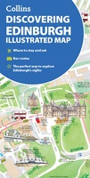 Stadsplattegrond Discovering Edinburgh Illustrated Map | Collins
Explore new places with dependable maps from Collins. This brand new edition retains the delightful water-colour mapping, with individual paintings of all the main sights and landmarks. This brand …
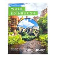 Stadsplattegrond - Wandelkaart Edinburg walk - Urban maps | Ordnance Survey
Laatste reviews

Geeft veel praktische informatie ter voorbereiding van de te organiseren reis.
★★★★★ door Willy Van Zanten 20 januari 2025 | Heeft dit artikel gekocht
Perfecte kwaliteit, had die heel graag in het nederlands kunnen bestellen
★★★★★ door Caty Eeckhout 20 januari 2025 | Heeft dit artikel gekocht
Helaas een aantal wandelroutes niet meer beloopbaar, de routes zijn niet meer te vinden. Ook zijn er routes aangepast,afstanden kloppen niet meer. Beter online opzoeken …
★★★★★ door Rieneke 20 januari 2025 | Heeft dit artikel gekocht
Geeft onze kinderen een realistische blik op de wereld. Met reliëf. En als lamp aan zie je de landsgrenzen. Mooie kwaliteit. Verrassend snelle verzending rondom …
★★★★★ door Jojanneke 20 januari 2025 | Heeft dit artikel gekocht

