Kaarten - Schotland
 Wegenkaart - landkaart 501 Schotland | Michelin
Zoals je van Michelin mag verwachten zijn het onmisbare overzichtskaarten van een uitstekende kwaliteit: een duidelijk en goed leesbaar kaartbeeld. Vrijwel alle berijdbare wegen staan er op ingetekend, in kleur …
★★★★★★★★★★ Wandelkaart Speyside Walk (Schotland) | Harvey Maps
Een bijzonder handige kaart van dit lange-afstands-wandelpad van 144 km. Op waterafstotend papier met veel details, uitstekend en voldoende voor deze route. A leap forward in technical excellence: Tough, durable …
 Wegenkaart - landkaart Great Britain - Engeland - Schotland | ITMB
Een degelijke kaart met aanduidingen van o.a. nationale parken, vliegveld, benzinepomp, dirt-roads en kleine plattegrond van hoofdstad. Als overzichtskaart goed te gebruiken. This is the third set of …
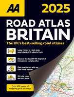 Wegenatlas Road Atlas Britain 2025 - A4 | AA Publishing
Wegenatlas, met spiraal, van Groot-Brittannie, Engeland, Wales en Schotland, met toeristische informatie This top-selling road atlas showcases Britain’s clearest mapping from the experts at the AA at a large 3.2 …
★★★★★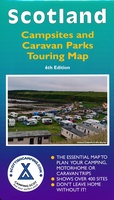 Camperkaart - Campinggids Scotland Campsites and Caravan Parks - Touring map | Scottishcamping.com
Dit soort kaarten zouden ze voor elk land moeten maken: heel duidelijk weergegeven vind je hier alle campings in Schotland op de voorzijde en op de achterzijde de adressen en …
 Wegenkaart - landkaart 9 Road Map Britain Scotland - Schotland | AA Publishing
Goede dubbelzijdige wegenkaart van Schotland met plaatsnamen index. Britain’s clearest mapping from the experts at the AA, in a handy foldable map. Fully updated, this map of Scotland combines clear …
★★★★★ Wegenkaart - landkaart - Stadsplattegrond Edinburgh & Southern Scotland | ITMB
Plattegrond van Edinburgh, schaal 1:10.000, met op de achterzijde een overzichtskaart van zuid Schotland, schaal 1:370.000. Legend Includes: Roads by classification, Airports, Ferry lines, Railways, Railway stations, Bus terminals, Bicycle …
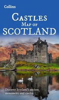 Wegenkaart - landkaart Castles map of Scotland - Schotland kastelen | Collins
Kaart waarop meer dan 700 kastelen in Schotland staan aangegeven. Discover Scotland's ancient monuments and castles. Explore Scotland’s ancient monuments with this pictorial map featuring over 700 castles and fortified …
★★★★★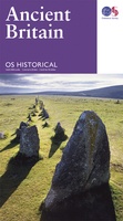 Wegenkaart - landkaart Ancient Britain | Ordnance Survey
The Ordnance Survey Ancient Britain map is a comprehensive guide to the most important archaeological sites of early English, Welsh and Scottish history. Ordnance Survey's Ancient Britain map shows Neolithic, …
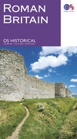 Wegenkaart - landkaart Roman Britain | Ordnance Survey
An informative map showing the location of the most important ancient monuments of Roman Britain. The map has been produced by Ordnance Survey in collaboration with the Ancient Monument Trusts …
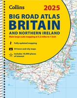 Wegenatlas Big Road Atlas Britain and Northern Ireland 2025 | A3 | Ringband | Collins
Grote wegenatlas, a3-formaat in ringband. The ultimate 3.2 miles to 1 inch scale large-format, spiral-bound road atlas of Britain, featuring Collins’ popular and well established road mapping, and designed for …
★★★★★★★★★★ Wandelkaart Ben Lawers & Schiehallion | Harvey Maps
Harvey Maps for hillwalkers showing the hills from Loch Tay to Glen Lyon. This detailed walking map includes Ben Lawers and the Tarmachan Ridge. The Superwalker XT25 is based on …
 Wandelkaart Arrochar Alps | Harvey Maps
Includes Beinn Ime, Ben Vorlich and the Cobbler (Ben Arthur). Detailed map for hillwalkers of the western part of the Loch Lomond and Trossachs National Park at the popular scale …
 Wandelkaart Arrochar Alps | Harvey Maps
Covers a large area yet is handily compact. Pocket perfect! Includes Beinn Ime, Ben Vorlich and the Cobbler (Ben Arthur). Detailed map for hillwalkers of the western part …
 Wandelkaart Ben Lawers & Schiehallion | Harvey Maps
40 years’ experience have gone into HARVEY’s most creative new series. Slim and light, the Ultramap covers a large area and yet is handily compact. Pocket perfect! Includes Ben …
 Wandelkaart Cairn Gorm & Ben Avon | Harvey Maps
40 years’ experience have gone into HARVEY’s most creative new series. Slim and light, the Ultramap covers a large area and yet is handily compact. Pocket perfect! Includes Cairn …
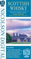 Wegenkaart - landkaart Scottish Whisky Distilleries Map | Schotse whiskystokerijen | Nicolson
Our brand new and up to date whisky map shows over 150 distilleries on our exceptionally clear road mapping, allowing you to navigate to your chosen destination. Enlarged inset map …
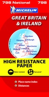 Wegenkaart - landkaart 798 Great Britain & Ireland | Michelin
Scheur- en watervast! Zoals je van Michelin mag verwachten is deze kaart zeer overzichtelijk en heeft een duidelijk helder kaartbeeld. De kaart geeft uitgebreid toeristische informatie weer. Met register, …
 Wandelkaart Ben Nevis | Harvey Maps
HARVEY launch innovative new series: Ultramap XT40. 16 titles featuring in Trail magazine through spring 2016. 40 years experience have gone into HARVEY's most creative new series. The Ultramap covers …
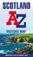 Wegenkaart - landkaart Visitors map Scotland - Schotland | A-Z Map Company
xplore the whole of Scotland from Dumfries and Galloway in the South to the Orkney Islands in the North. With detailed road mapping and illustrated town plans of major cities, …
- 1
- 2
- 3
- Volgende >>
- 5
Laatste reviews

Geeft veel praktische informatie ter voorbereiding van de te organiseren reis.
★★★★★ door Willy Van Zanten 20 januari 2025 | Heeft dit artikel gekocht
Perfecte kwaliteit, had die heel graag in het nederlands kunnen bestellen
★★★★★ door Caty Eeckhout 20 januari 2025 | Heeft dit artikel gekocht
Helaas een aantal wandelroutes niet meer beloopbaar, de routes zijn niet meer te vinden. Ook zijn er routes aangepast,afstanden kloppen niet meer. Beter online opzoeken …
★★★★★ door Rieneke 20 januari 2025 | Heeft dit artikel gekocht
Geeft onze kinderen een realistische blik op de wereld. Met reliëf. En als lamp aan zie je de landsgrenzen. Mooie kwaliteit. Verrassend snelle verzending rondom …
★★★★★ door Jojanneke 20 januari 2025 | Heeft dit artikel gekocht

