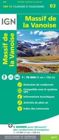
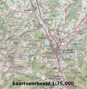
Fietskaart - Wandelkaart 75003 Massif de la Vanoise | IGN - Institut Géographique National (9782758554660)
Mont Jovet, Champagny-en-Vanoise, Pointe de l’Echelle, Lac de la Plagne, Col de Chavière
- ISBN / CODE: 9782758554660
- Editie: 12-06-2023
- Druk: 3
- Aantal blz.: 1
- Schaal: 1:75000
- Uitgever: IGN - Institut Géographique National
- Soort: Fietskaart, Wandelkaart
- Serie: Top 75
- Taal: Engels, Frans
- Hoogte: 24.0 cm
- Breedte: 11.0 cm
- Gewicht: 89.0 g
- Uitvoering: Papier
- Bindwijze: -
- Schrijf als eerste een review
-
€ 12,50
Op voorraad. Voor 17.00 uur op werkdagen besteld, binnen 1 tot 2 werkdagen in huis in Nederland Levertijd Belgie
Gratis verzending in Nederland vanaf €35,-
-
Overzicht IGN Wandelkaarten 1:75.000
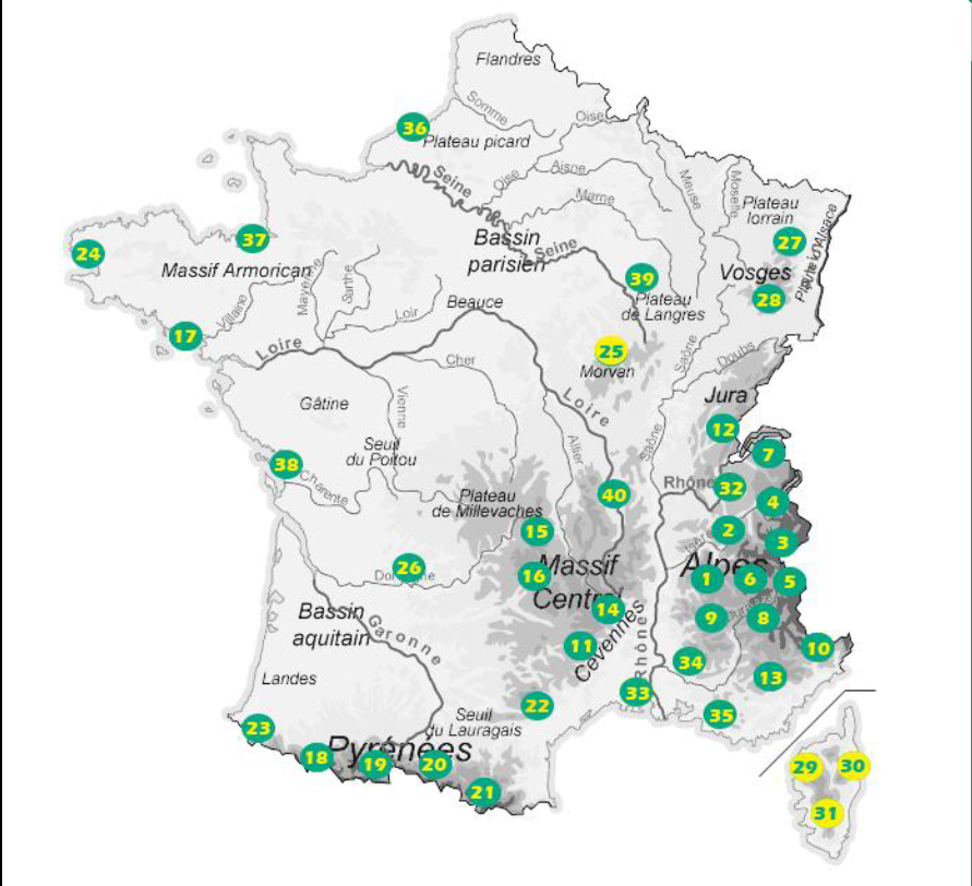
Producten op deze overzichtskaart:
Klik op een product om naar de pagina van dat product te gaan.
- Fietskaart - Wandelkaart 75001 Massif du Vercors | IGN - Institut Géographique National
- Fietskaart - Wandelkaart 75002 Chartreuse - Belledonne | IGN - Institut Géographique National
- Fietskaart - Wandelkaart 75003 Massif de la Vanoise | IGN - Institut Géographique National
- Fietskaart - Wandelkaart 75004 Beaufortin Massif du Mont Blanc | IGN - Institut Géographique National
- Fietskaart - Wandelkaart 75005 Briançonnais – Queyras | IGN - Institut Géographique National
- Fietskaart - Wandelkaart 75006 Oisans Champsaur - Massif des Ecrins | IGN - Institut Géographique National
- Fietskaart - Wandelkaart 75007 Entre Léman et Mont Blanc | IGN - Institut Géographique National
- Fietskaart - Wandelkaart 75008 Ubaye, Val d'Allos, Lac de Serre-Poncon | IGN - Institut Géographique National
- Fietskaart - Wandelkaart 75009 Diois, Devoluy, Haute-Vallée de la Drôme | IGN - Institut Géographique National
- Fietskaart - Wandelkaart 75010 Mercantour | IGN - Institut Géographique National
- Wandelkaart - Fietskaart 75011 Cevennes PRN - Gorges du Tarn | IGN - Institut Géographique National
- Fietskaart - Wandelkaart 75012 Haut-Jura | IGN - Institut Géographique National
- Fietskaart - Wandelkaart 75013 Verdon, Lac de Sainte-Croix, Valensole | IGN - Institut Géographique National
- Fietskaart - Wandelkaart 75014 Gorges et Monts d'Ardèche - Ardeche | IGN - Institut Géographique National
- Wandelkaart - Fietskaart 75015 Chaîne des Puys - Massif du Sancy – Auvergne | IGN - Institut Géographique National
- Wandelkaart - Fietskaart 75016 Cézallier – Monts du Cantal | IGN - Institut Géographique National
- Wandelkaart - Fietskaart 75017 Golfe du Morbihan | IGN - Institut Géographique National
- Fietskaart - Wandelkaart 75018 Vignemale - Pic De Ger - Vallee D'Ossau | IGN - Institut Géographique National
- Fietskaart - Wandelkaart 75019 Gavarnie Néouvielle | IGN - Institut Géographique National
- Fietskaart - Wandelkaart 75020 Pyrenees Ariegeoises, Mont Valier, Pique d'Estats | IGN - Institut Géographique National
- Fietskaart - Wandelkaart 75021 Pyrénées Catalanes - Font-Romeu / Massif Canigou | IGN - Institut Géographique National
- Fietskaart - Wandelkaart 75022 Haut-Languedoc | IGN - Institut Géographique National
- Fietskaart - Wandelkaart 75023 Pays Basque | IGN - Institut Géographique National
- Fietskaart - Wandelkaart 75024 Bretagne - Pointe du Raz, Presqu'ile de Crozon, Ouessant - les Abers | IGN - Institut Géographique National
- Fietskaart - Wandelkaart 75025 Morvan | IGN - Institut Géographique National
- Fietskaart - Wandelkaart 75026 Perigord Noir - Haut Quercy | IGN - Institut Géographique National
- Fietskaart - Wandelkaart 75027 Vosges du Nord - Mont Sainte Odile - Le Donon | IGN - Institut Géographique National
- Fietskaart - Wandelkaart 75028 Vosges du Sud - Ballon d'Alsace - Le Hohneck | IGN - Institut Géographique National
- Fietskaart - Wandelkaart 75029 Calvi Cargese Corsica | IGN - Institut Géographique National
- Fietskaart - Wandelkaart 75030 Bastia Corte Corsica | IGN - Institut Géographique National
- Fietskaart - Wandelkaart 75031 Ajaccio - Porto Vecchio - Corsica | IGN - Institut Géographique National
- Fietskaart - Wandelkaart 75032 Chaine des Aravis - Massif des Bauges | IGN - Institut Géographique National
- Fietskaart - Wandelkaart 75033 Camargue - Alpilles - Provence | IGN - Institut Géographique National
- Wandelkaart - Fietskaart 75034 Luberon - Mont Ventoux | IGN - Institut Géographique National
- Fietskaart - Wandelkaart 75036 Baie De Somme - Cote d'Albatre - Fecamp - Etretat - Normandië | IGN - Institut Géographique National
- Fietskaart - Wandelkaart 75037 Bretagne: Saint Malo - Côte d'Emeraude - Mont Saint-Michel | IGN - Institut Géographique National
- Wandelkaart - Fietskaart 75038 Île de Ré, Île d'Oléron, Marais Poitevin | IGN - Institut Géographique National
- Wandelkaart - Fietskaart 75039 Forêt d'Orient, Lac du Der-Chantecoq | IGN - Institut Géographique National
- Wandelkaart - Fietskaart 75040 Massif du Pilat - Monts du Forez | IGN - Institut Géographique National
Overzichtskaarten
Beschrijving
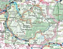
Bourg-St-Maurice, la Rosière, Séez, Ste-Foy-Tarentaise, Tignes, Val d’Isère, la Plagne, les Arces, Moûtiers, Aiguebelle, Aigueblanche, Aime, Bozel, Courchevel, St-Martin-de-Belleville, St-Jean-de-Maurienne, St-Michel-de-Maurienne, Aussois, Termignion, Lanslebourg, Lanslevillard, Bessans, Boneval-sur-Arc, as well as the peaks of the Vanoise Massif: Mont Pourri, Dôme de la Sache, La Grande Casse, La Grande Motte, La Dent Parrachée and Aiguille de Péclet, Massif du Mont Cenis, Col de l’Iseran
Reviews
Geen reviews gevonden voor dit product.
Schrijf een review
Graag horen wij wat u van dit artikel vindt. Vindt u het goed, leuk, mooi, slecht, lelijk, onbruikbaar of erg handig: schrijf gerust alles op! Het is niet alleen leuk om te doen maar u informeert andere klanten er ook nog mee!

