Categorieën
- Nieuwe artikelen
-
Boeken
- Aanwijswoordenboeken
- Accommodatiegidsen
- Atlassen
- Bed and Breakfast Gidsen
- Bergsporthandboeken
- Campergidsen
- Camperhandboeken
- Campinggidsen
- Duikgidsen
- Fietsatlassen
-
Fietsgidsen
- Afrika
- Azië
-
Europa
- Albanië
- België
- Bosnië - Hercegovina
- Bulgarije
- Cyprus
- De Alpen
- Denemarken
- Duitsland
-
Engeland
- North East England
- ♦ Northumberland National Park
- Yorkshire and the Humber
- ♦ Yorkshire Dales Nationaal Park
- North West England
- ♦ Cumbria
- ♦ Lake District Nationaal Park
- 🥾 Hadrian's Wall Path
- West Midlands
- ♦ Peak District Nationaal Park
- Wales
- ♦ Brecon Beacons Nationaal Park
- East of England - East Anglia
- South West England
- ♦ Cotswolds AONB
- ♦ Devon - Cornwall
- South East England
- ♦ Kent
- ■ Londen
- 🚲 North Sea Cycle fietsroute
- Estland
- Fietsnet Europa LF
- Finland
- Frankrijk
- Griekenland
- Hongarije
- Ierland
- Italië
- Kroatië
- Letland
- Litouwen
- Luxemburg
- Montenegro
- Nederland
- Noord-Macedonië
- Noorwegen
- Oekraïne
- Oostenrijk
- Polen
- Portugal
- Roemenië
- Rusland
- Schotland
- Servië
- Slovenië
- Slowakije
- Spanje
- Tsjechië
- Turkije
- Zweden
- Zwitserland
- Midden-Amerika
- Noord-Amerika
- Oceanië
- Wereld
- Zuid-Amerika
- Fotoboeken
- Historische Atlassen
- Kanogidsen
- Kinderatlassen
- Kinderreisgidsen
- Kleurboeken
- Klimgids - Klettersteiggidsen
- Klimgids - Klimtopo
- Kookboeken
- Mountainbikegidsen
- Natuurgidsen
- Pelgrimsroutes
- Reisboeken
- Reisdagboeken
- Reisfotografiegidsen
- Reisgidsen
- Reishandboeken
- Reisinspiratieboeken
- Reisverhalen
- Sneeuwschoenwandelgidsen
- Survivalgidsen
- Tourskigidsen
- Treinreisgidsen
- Vaargidsen
- Vogelgidsen
- Wandelgidsen
- Watersport handboeken
- Werken en wonen in buitenland
- Woordenboeken & Taalgidsen
- Kaarten
- Opruiming
- Puzzels
- Travel Gadgets
- Wandkaarten
- Wereldbollen
Veilig online betalen
Betaal veilig via uw eigen bankomgeving
- U bent hier:
- Home
- Europa
- Engeland
- North East England
- Boeken
- Fietsgidsen
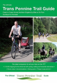
Fietsgids The Ultimate Trans Pennine Trail Guide | Excellent Books (9781901464368)
- ISBN / CODE: 9781901464368
- Editie: 2017
- Aantal blz.: 152
- Auteur(s): Richard Peace
- Uitgever: Excellent Books
- Soort: Fietsgids
- Taal: Engels
- Bindwijze: RIngband
- Uitvoering: -
- Schrijf als eerste een review
-
€ 13,95
Op voorraad. Binnen 2 - 3 werkdagen in huis in Belgie Levertijd Nederland Voor 17.00 uur op werkdagen besteld, binnen 1 tot 2 werkdagen in huis in Nederland Levertijd Belgie
Gratis verzending in Nederland vanaf €35,-
- Afbeeldingen
- Inkijkexemplaar
Beschrijving
Gidsboek voor de Trans Pennine Trail met spiraalbinding, inclusief kaarten, hoogtegrafieken en verblijfsmogelijkheden.
Reviews
Geen reviews gevonden voor dit product.
Schrijf een review
Graag horen wij wat u van dit artikel vindt. Vindt u het goed, leuk, mooi, slecht, lelijk, onbruikbaar of erg handig: schrijf gerust alles op! Het is niet alleen leuk om te doen maar u informeert andere klanten er ook nog mee!
Ook interessant voor europa/engeland/north-east-england
-

Wegenkaart - landkaart 4 OS Road Map
€ 12,95Wegenkaarten North East England -

Fietskaart mountainbike Coast to Coa
€ 28,50Fietskaarten ♦ Yorkshire Dales Nationaal Park -

Fietsgids Cycling in the Peak Distri
€ 18,50Fietsgidsen West Midlands -

Wandelgids Peak District | Northern
€ 10,95Wandelgidsen West Midlands -

Reisgids Slow Travel The Peak Distri
€ 20,95Reisgidsen West Midlands


