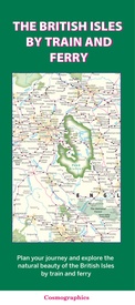
Spoorwegenkaart The British Isles by Train and Ferry | Cosmographics (9780957447226)
Plan your journey and explore the British Isles by train and ferry
- ISBN / CODE: 9780957447226
- Editie: 2023
- Schaal: 1:1250000
- Uitgever: Cosmographics
- Soort: Spoorwegenkaart
- Taal: Engels
- Hoogte: 25.0 cm
- Breedte: 11.0 cm
- Bindwijze: -
- Uitvoering: Papier
- Schrijf als eerste een review
-
€ 19,50
Levertijd 2 - 4 werkdagen in huis in Nederland Levertijd Belgie
Gratis verzending in Nederland vanaf €35,-
Beschrijving
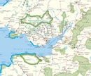
- Passenger rail network with the majority of stations.
- Seasonal and heritage railways
- Ferry routes
- National Parks
- Areas of Outstanding Natural Beauty
- Main forest and woodland areas
- Heritage coast in England and Wales
Formaat: 74.5cm x 110cm
Reviews
Geen reviews gevonden voor dit product.
Schrijf een review
Graag horen wij wat u van dit artikel vindt. Vindt u het goed, leuk, mooi, slecht, lelijk, onbruikbaar of erg handig: schrijf gerust alles op! Het is niet alleen leuk om te doen maar u informeert andere klanten er ook nog mee!


