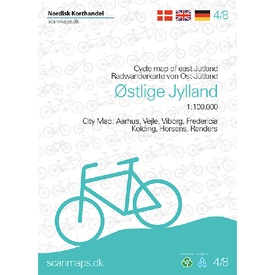
Fietskaart 4/8 Østlige Jylland - Oostelijk Jutland (Denemarken) | Scanmaps (9788779671782)
- ISBN / CODE: 9788779671782
- Editie: 13-06-2023
- Druk: 4
- Aantal blz.: 1
- Schaal: 1:100000
- Uitgever: Scanmaps
- Soort: Fietskaart
- Taal: Engels
- Hoogte: 18.0 cm
- Breedte: 13.0 cm
- Gewicht: 100.0 g
- Uitvoering: Scheur- en watervast
- Bindwijze: -
- Beoordeling: 5,0 ★★★★★ (2 reviews) Schrijf een review
-
€ 22,50
Op voorraad. Voor 17.00 uur op werkdagen besteld, binnen 1 tot 2 werkdagen in huis in Nederland Levertijd Belgie
Gratis verzending in Nederland vanaf €35,-
-
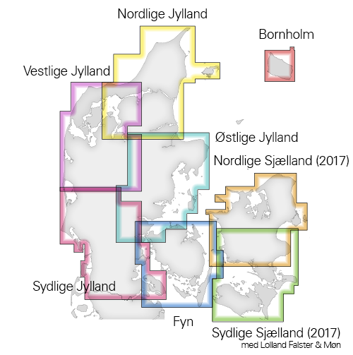
Overzicht Fietskaarten Denemarken


Producten op deze overzichtskaart:
Klik op een product om naar de pagina van dat product te gaan.
- Fietskaart 1/8 Nordlige Sjaelland - Noord Zeeland (Denemarken) | Scanmaps
- Fietskaart 2/8 Sydlige Sjælland, Møn, Lolland og Falster Cykelkort | Scanmaps
- Fietskaart 3/8 Fyn - Funen (Denemarken) | Scanmaps
- Fietskaart 4/8 Østlige Jylland - Oostelijk Jutland (Denemarken) | Scanmaps
- Fietskaart 5/8 Nordlige Jylland - Noordelijk Jutland | Scanmaps
- Fietskaart 6/8 Vestlige Jylland - West Jutland (Denemarken) | Scanmaps
- Fietskaart 7/8 Sydlige Jylland - Zuid Jutland (Denemarken) | Scanmaps
- Fietskaart 8/8 Bornholm (Denemarken) | Scanmaps
Overzichtskaarten
Beschrijving
Reviews
Heerlijk compleet. Watervast, heel veel informatie en overzichtelijk. Heb ook de kaarten van noord-, west- en zuid-Jutland besteld. Omdat die uit 2016 zijn staan de 'wild'-kampeerplekken daar niet op. Voor ons erg onhandig. Oost-Jutland uit 2019 geeft die plekken dan weer wel weer. Lijkt er op dat 2016 in dat opzicht verouderd is.
★★★★★ door Kees Meijer 23 augustus 2021Vond u dit een nuttige review? (login om te beoordelen)
Superveel informatie. Heel handig. alles staat erop wat een fietser wil weten, campings, routenummers etc.
★★★★★ door Alie Trouw 10 juli 2019Vond u dit een nuttige review? (login om te beoordelen)
Schrijf een review
Graag horen wij wat u van dit artikel vindt. Vindt u het goed, leuk, mooi, slecht, lelijk, onbruikbaar of erg handig: schrijf gerust alles op! Het is niet alleen leuk om te doen maar u informeert andere klanten er ook nog mee!


