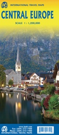
Wegenkaart - landkaart Central Europe - Europa centraal | ITMB (9781771291729)
- ISBN / CODE: 9781771291729
- Editie: 01-09-2021
- Druk: 1
- Aantal blz.: 1
- Schaal: 1:1200000
- Uitgever: ITMB
- Soort: Wegenkaart
- Taal: Engels
- Hoogte: 25.0 cm
- Breedte: 10.0 cm
- Gewicht: 54.0 g
- Uitvoering: Papier
- Bindwijze: -
- Schrijf als eerste een review
-
€ 14,50
Leverbaar in 3 - 5 werkdagen in huis in Nederland Levertijd Belgie
Gratis verzending in Nederland vanaf €35,-
Beschrijving
Van de uitgever
Wegenkaart Centraal Europa
Europe is fairly big, and densely populated. A map of all of Europe is useful, but at a scale that limits our ability to show information. As a result, last year we published a map of Western Europe. Now, we are pleased to extend our more detailed coverage of the continent with a map covering the Central European countries of Germany, Austria, Poland, Czech Republic, Hungary, Slovakia, and Switzerland, with portions of France, Belarus, Serbia, and Romania. A third map, covering eastern European countries, will be released soon, providing detailed regional coverage of the continent in a way that we hope is pleasing. Germany occupies most of the first side, and Poland the other, with Czech and Slovakia divided between the two sides, and Slovakia/Hungary filling the rest of side 2. This is a regional map, showing rail lines as well and roads, airports, and major touristic attractions. A listing of the region’s top attractions is included. This map will appeal to those visiting several countries on one trip, by rail or road.
Legend Includes:
Roads by classification, Rivers and Lakes, National Park, Airports, Points of Interests, Highways, Main Roads, Zoos, Fishing, and much more...
Reviews
Geen reviews gevonden voor dit product.
Schrijf een review
Graag horen wij wat u van dit artikel vindt. Vindt u het goed, leuk, mooi, slecht, lelijk, onbruikbaar of erg handig: schrijf gerust alles op! Het is niet alleen leuk om te doen maar u informeert andere klanten er ook nog mee!


