Mandje Tel: +31503126950 Menu
Winkelwagen
Geen items in winkelwagen
Ga naar winkelwagen

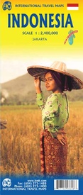
Wegenkaart - landkaart Indonesië - Indonesia | ITMB (9781771293648)

  • ISBN / CODE: 9781771293648
  • Editie: 13-07-2018
  • Druk: 5
  • Aantal blz.: 1
  • Schaal: 1:2400000
  • Uitgever: ITMB
  • Soort: Wegenkaart
  • Taal: Engels
  • Hoogte: 25.0 cm
  • Breedte: 10.0 cm
  • Gewicht: 76.0 g
  • Uitvoering: Scheur- en watervast
  • Beoordeling: 4,0 ★★★★★ (1 review) Schrijf een review
  • 13,95

    Dit artikel is (tijdelijk) niet leverbaar Dit artikel is (tijdelijk) niet leverbaar

Beschrijving

Een degelijke landkaart van Indonesië met aanduidingen van o.a. nationale parken, vliegvelden en grote wegen. Als overzichtskaart goed te gebruiken. De nadruk ligt echter vooral op de natuurkundige aspecten. Scheur- en watervast! Met een kleine kaart van Jakarta.

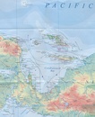
The hundreds of islands making up the island nation of Indonesia make a double-sided map inevitable in order to show any significant amount of detail. Side 1 shows the western half, starting with Sumatra in the upper left and including Java and most of the island of Borneo (Kalimantan Province to the Indonesians). This side also includes a large inset map of central Jakarta (for better detail see our separate map of the city); ditto for Sumatra, Java, and Borneo. Bali, Lombok, and Sumbawa islands are in the lower right portion of the map, and most of Malaysia and all of Singapore are included, simply because they are there. The infamous volcanic island of Krakatoa is located just to the west of Java. The other side of the map covers the less-travelled and therefore more interesting eastern islands – Sulawesi, Flores, New Guinea (West Irian Province), and Timor are the best known. Komodo National Park, home of the fierce lizards called Komodo Dragons, is on the map. Ferry routes between the islands are shown and are quite reliable, but sailings are subject to weather conditions. Indonesia is a very large country, and this map shows it in good detail. However, it is also a country that covers a very large area. For this reason, ITMB has also published several sectional maps of islands within the country in order to show touristic areas with an improved scale. Bali & Lombok, Borneo, Java, Jakarta, and Sumatra maps are also available from ITMB. 
 
Legend Includes:
Motorway, Major Highway, Main Road, Other Road, Railway, Ferry Route, River / Waterfall and Lake, International Airport, Domestic Airport, Hotel, Longhouse / Shelter / Lodge, Museum, Hot Spring, Fort / Fortress, Skiing,National Park, Zoo, Beach, Water Sport, Diving, Fishing, Wild Life / Bird Reserve, etc.

Reviews

Vakantieplanning Indonesië

De kaart is mooi gedetailleerd en daardoor goed te gebruiken om een vakantie te plannen.Veel vliegvelden staan er op en zo kun je in combinatie met vliegmaatschappijen een mooie reis plannen.Het enige nadeel is dat sommige plaatsnamen nog op de oude manier worden aangegeven, maar met een beetje puzzelen kom je daar goed uit.

★★★★★ door Mirjam Bakker 9 november 2012

Vond u dit een nuttige review? (login om te beoordelen)

-
Nee (0)

Schrijf een review

Graag horen wij wat u van dit artikel vindt. Vindt u het goed, leuk, mooi, slecht, lelijk, onbruikbaar of erg handig: schrijf gerust alles op! Het is niet alleen leuk om te doen maar u informeert andere klanten er ook nog mee!